Wk 13 – Route des Grandes Alpes

Monday 17th to Sunday 23rd June

Mon 17th June – Tignes – 145k

3 Passes – Col des Saisies 1657m, Col de Méraillet 1605m, Cormet de Roselend 1967m

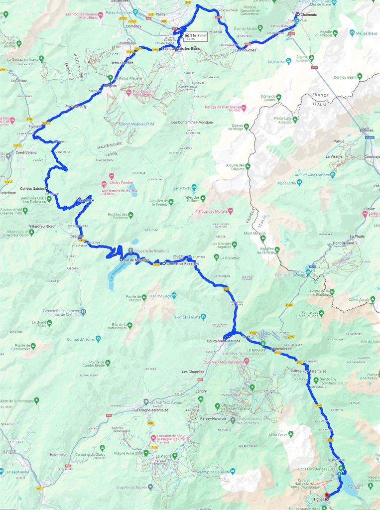
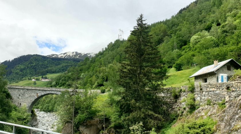
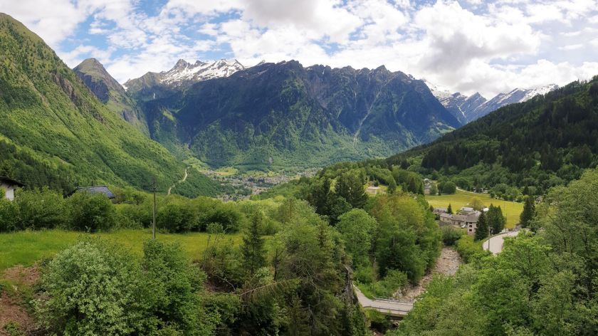
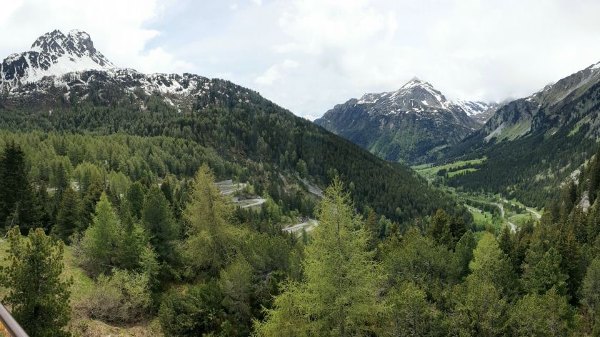
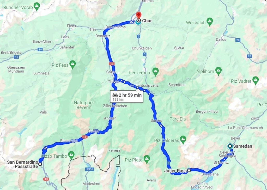
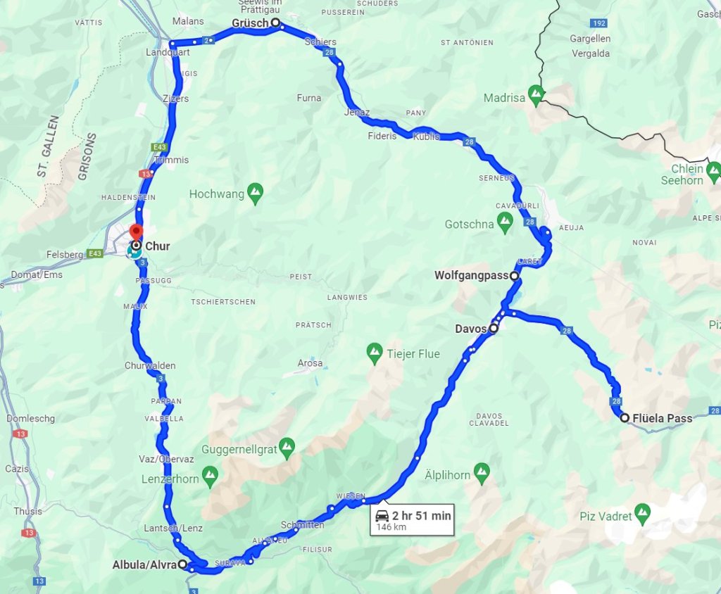
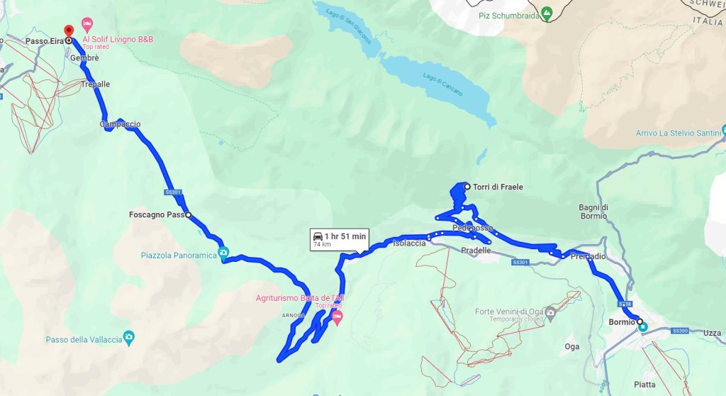
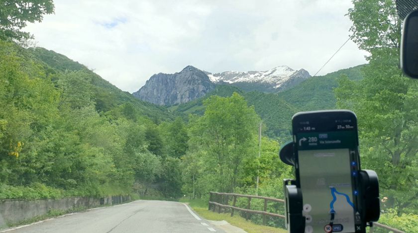
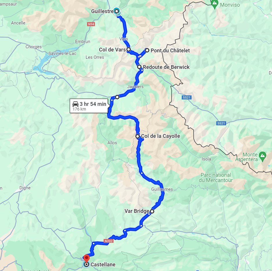
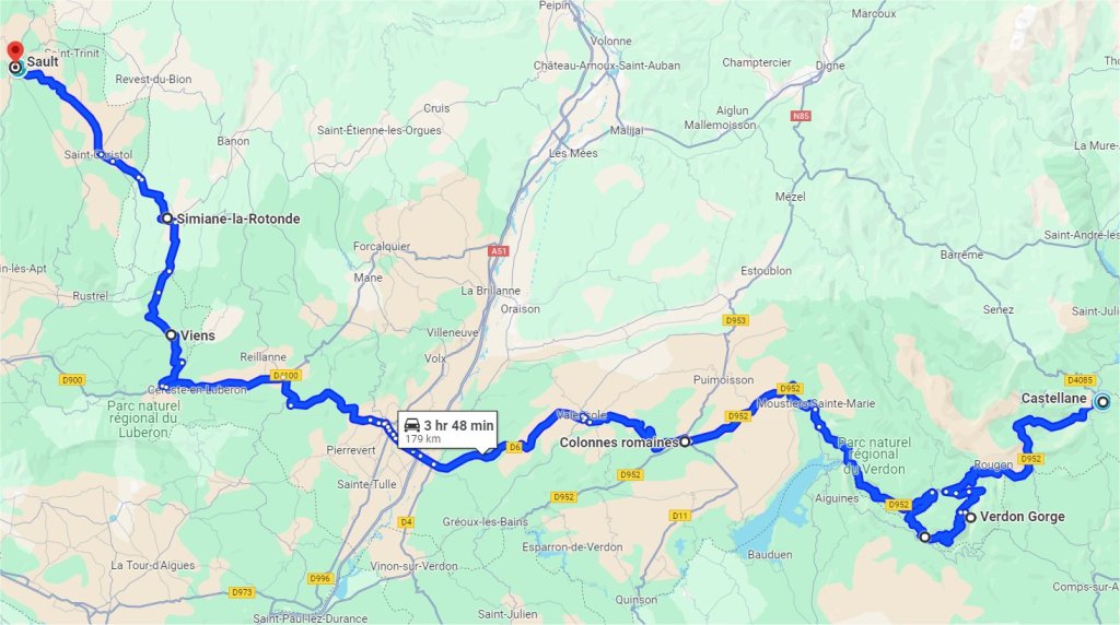
On a clear morning we took our leave of the hustle and bustle of Chamonix, with its constant toing and froing at the bus station across the road from our apartment. We headed west for the Route des Grandes Alpes which follows the French Alps for 750klms from Lake Geneva to The Riviera. We would be doing 655klms of it from Chamonix to Castellane, taking 6 days and 4 stays, plus a couple of detours.

Our Route des Grandes Alpes

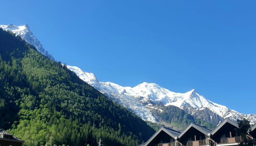
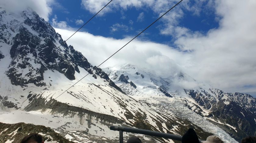
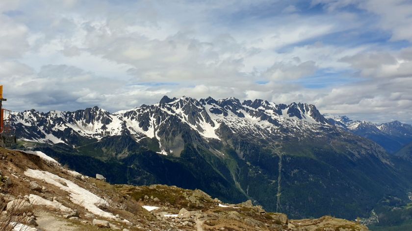
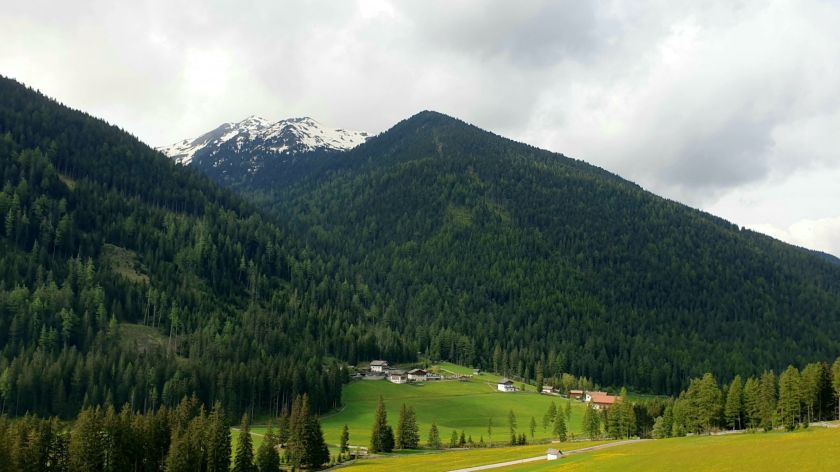
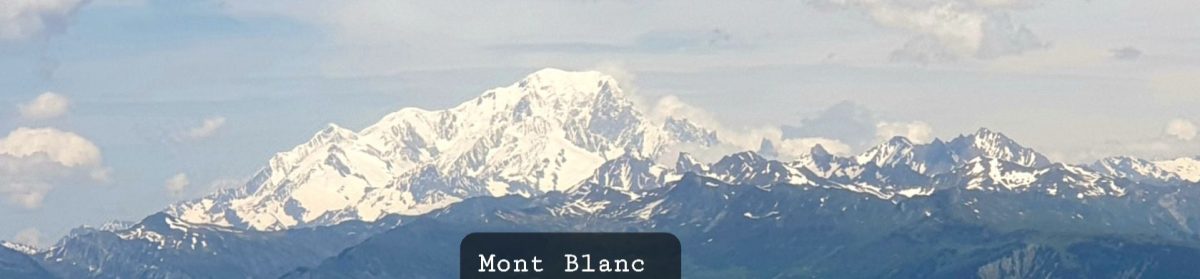
So, prior to that distraction, we were heading west and through the trees we managed to catch a glimpse of that elusive Mont Blanc.

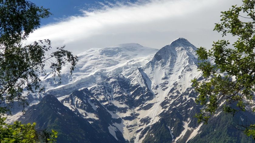
A shy Mont Blanc – the hindmost unimpressive bump.

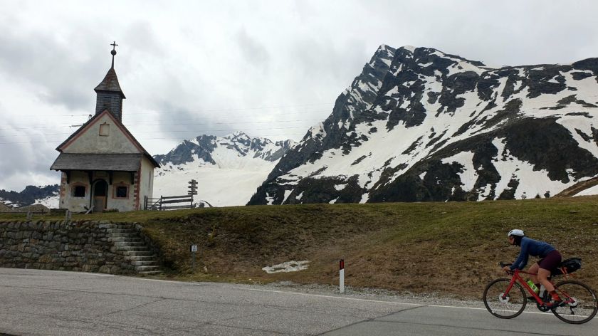
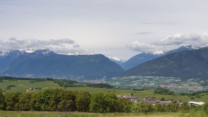
We never tier of the classic Alpine view.

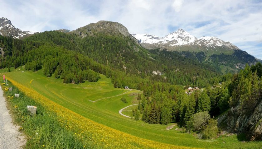
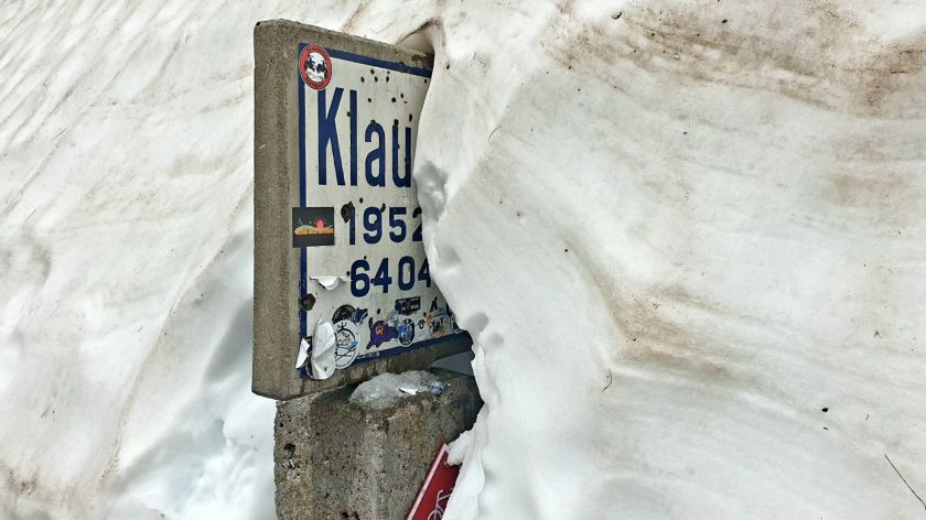
Col des Saisies at under 1700m doesn’t seem to warrant a marker. But the outlook is marvellous.

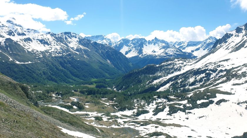
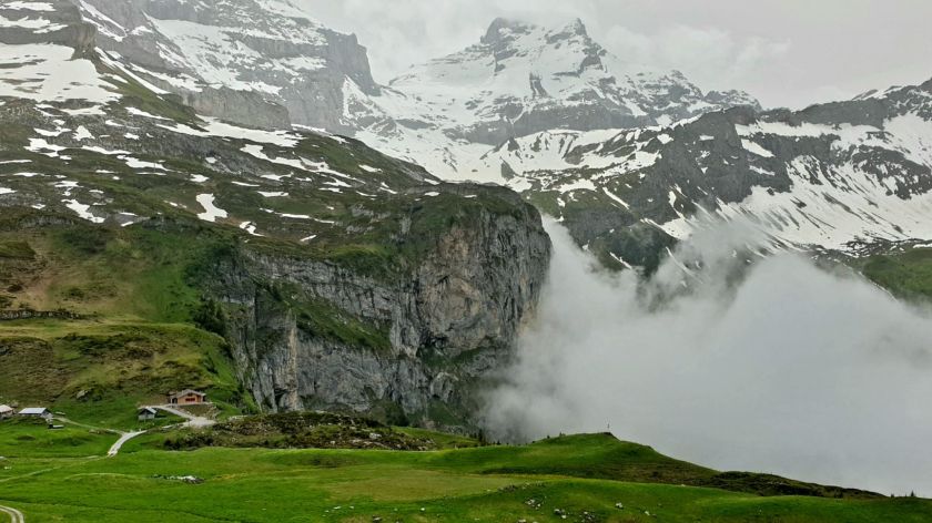
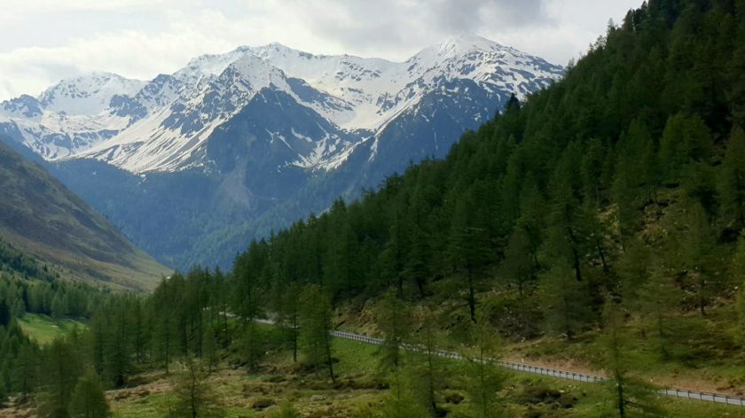
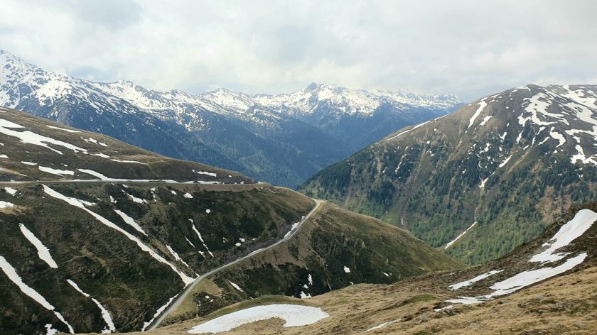
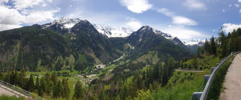
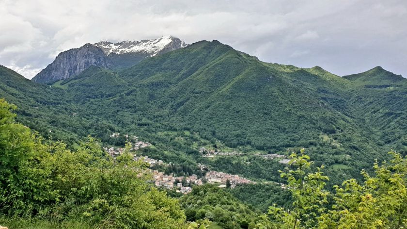
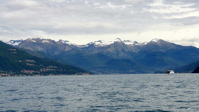
Now we are heading south with those snow capped Alps a close neighbour to our left.

Col de Méraillet had its fair share of cyclists and moto riders and so deserved its marker post.

Col de Méraillet

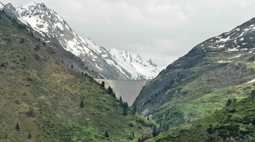
Which is flanked by Lac de Roselend and its 150m high wall.
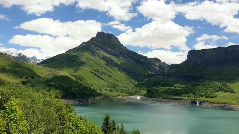
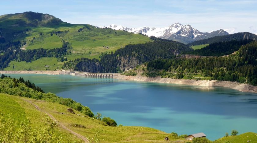
Barrage de Roselend

About 10 winding and picturesque kilometres down the road is Cormet de Roselend

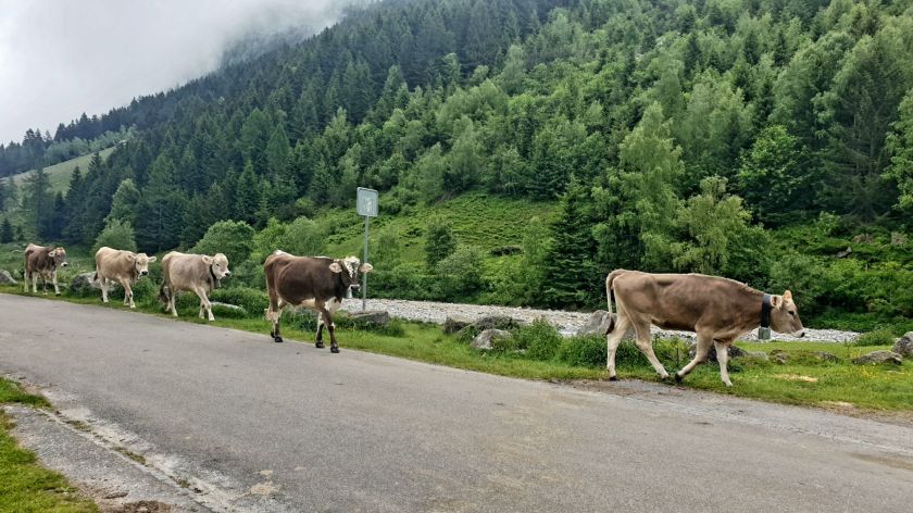
Lots of cattle about.

Cormet de Roselend was quite busy.

These guys on their Vespas in full touring setup. As I walked past them I called ‘Smile Guys’ and they did, as did half a dozen sports bike riders next to them whom were ignored 🙂 – made the Vespa boys day. We passed them again just north of Castellane so they’d covered some ground.

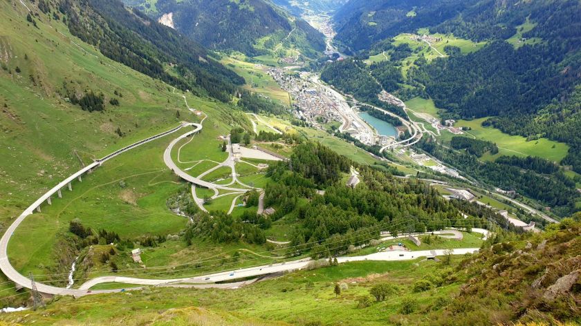
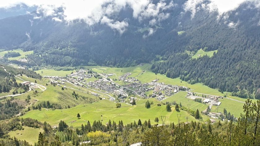
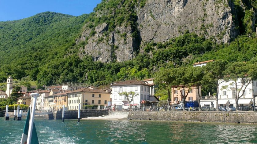
The ski resort of Tignes was our destination for the night. It was very quiet being the ‘tween season.

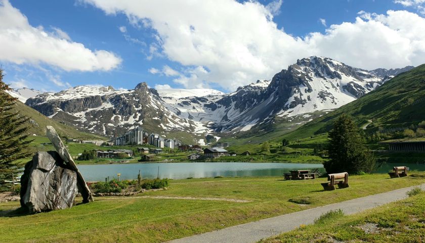
That’s a very classy ski resort on the other side of the lake. Not on our budget.

The 180m Barrage de Tignes

Tues 18th – Saint-Michel-de Maurienne – 195k

3 Passes – Col de L’Iseran 2764m, Col du Tra 1306m, Col de la Madeleine 1993m.

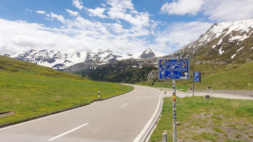
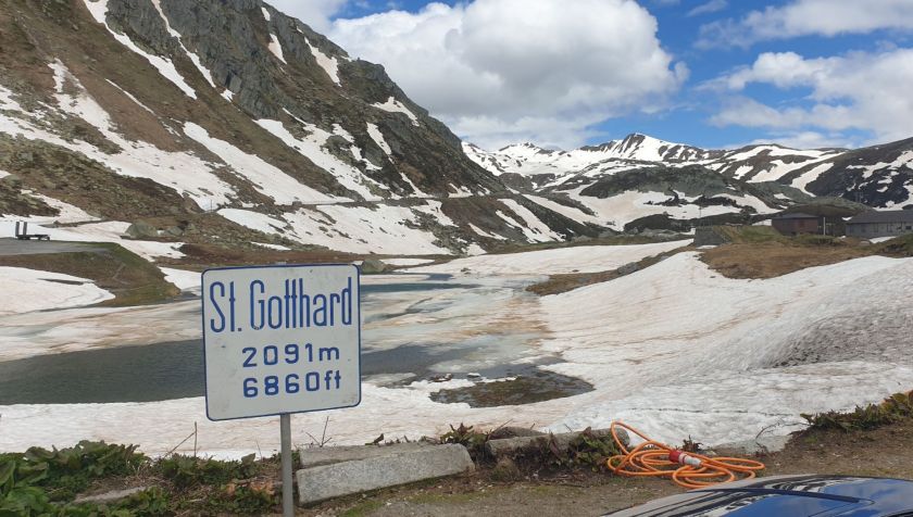
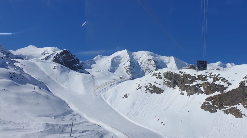
Our day started with a 20klms detour to Col de L’Iseran which, at 2764m, is the highest paved pass in all the Alps, pipping Stelvio Pass by 7m.

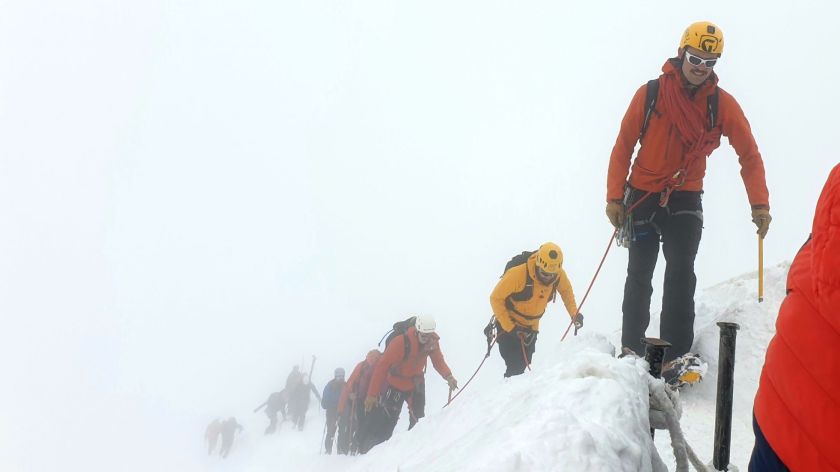
Lots of bikers (: We all turned around and retraced our steps.

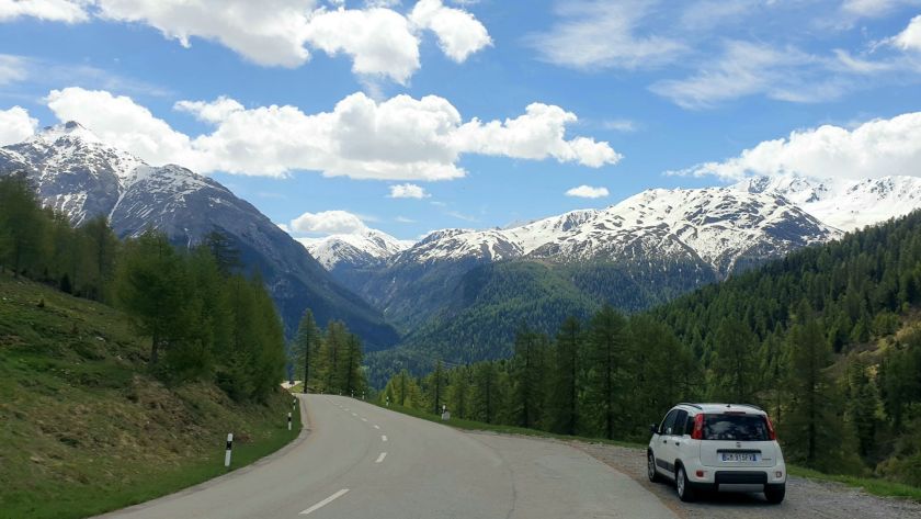
If you wondering why one would endure all those kilometres up hill and down dale on narrow winding and inhospitable roads just to get a picture and then retrace ones steps, it’s probable you don’t ride a motorcycle. Because it’s not about the picture, it’s actually all about all those kilometres up hill and down dale on narrow winding and inhospitable roads. You can take a bloke and his pillion off their moto and put them in a little white Hybrid butter-box Fiat 500 Panda car, but he’s still chasing the dream – however his pillion has been seen to roll her eyes on occasions.

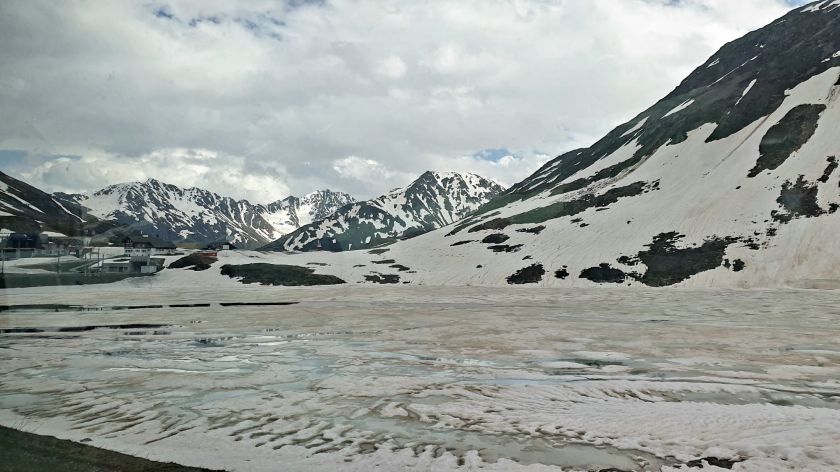
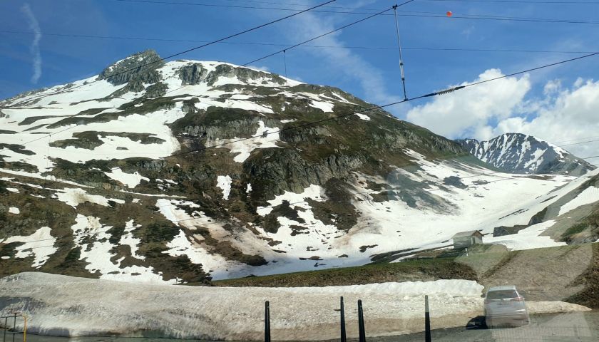
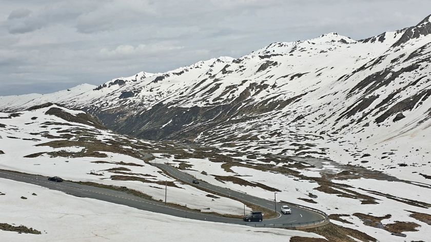
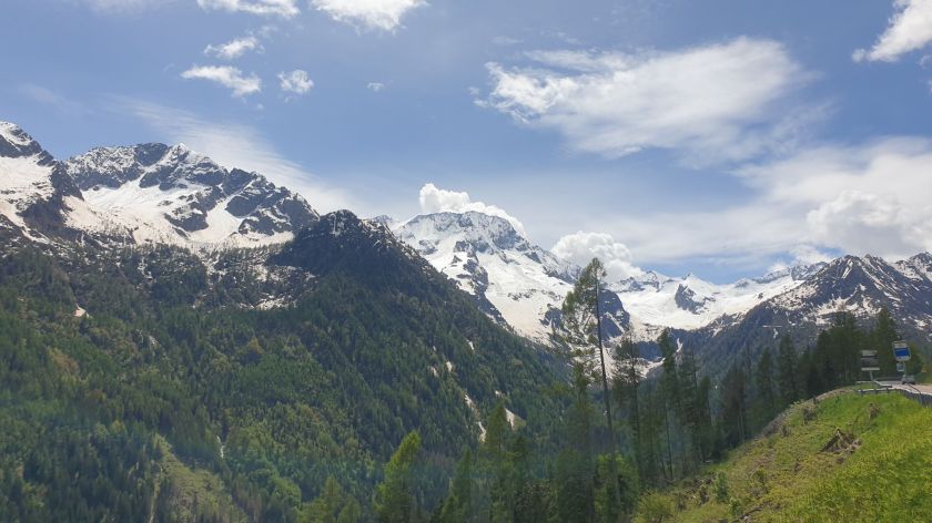
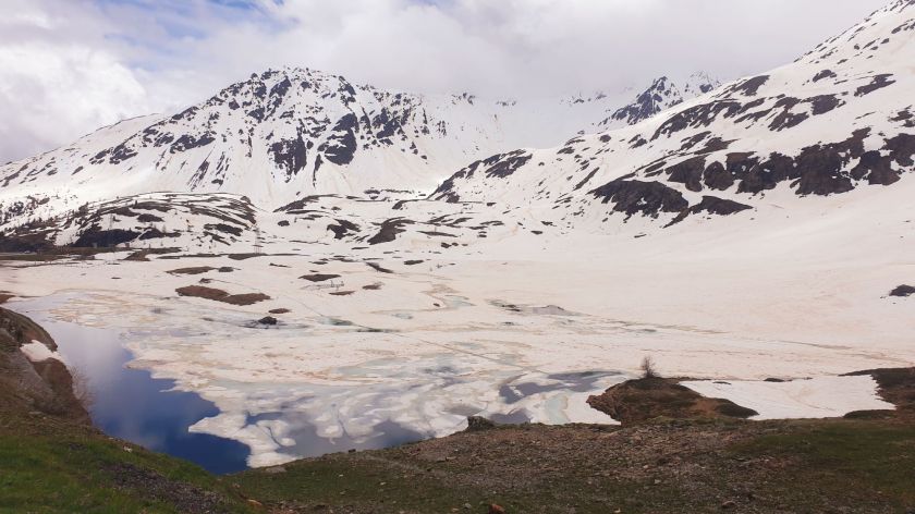
A lot of skiing still happening over there.

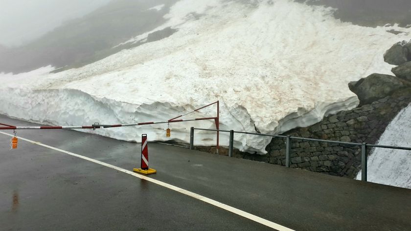
And still lots of white stuff

The white stuff is the reason the southern side of the Col de l’Iseran is closed, so it was 50klms back to Bourg-Saint-Maurice and a loop to the SW.

Col du Tra isn’t so much about itself because its only 1300m high,

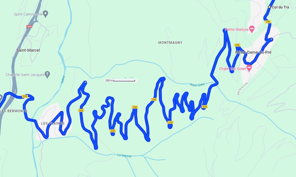
but its descent is something else. 27 genuine hairpins over 9klms, but only about 2klms straight down.

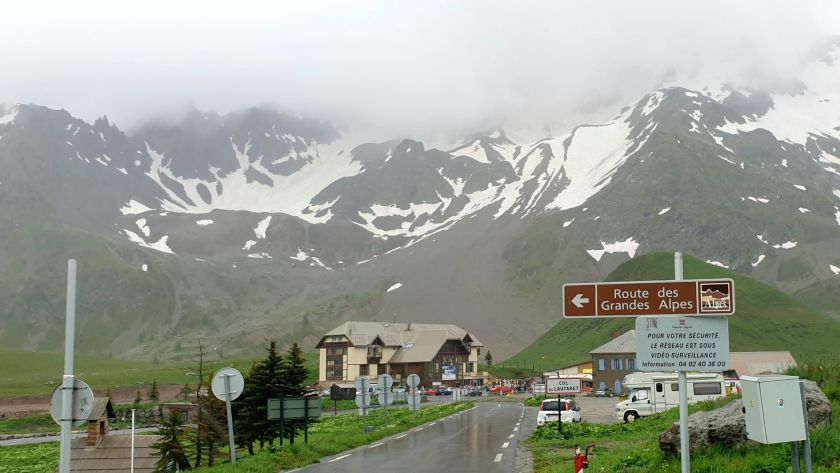
It was Moûtiers for lunch and a quiet sit and watch the world doing it’s thing, before another epic climb to Col de la Madeleine which was as busy as it gets. It has featured in La Tour 27 times between 1969 and 2022. I think it’ll see the Tour’s madness again this year.

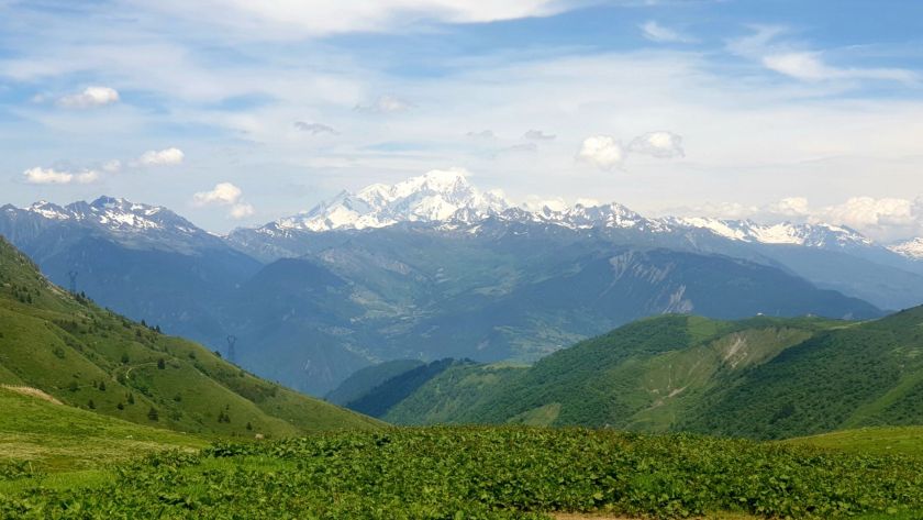
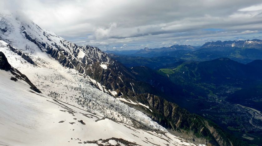
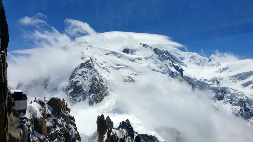
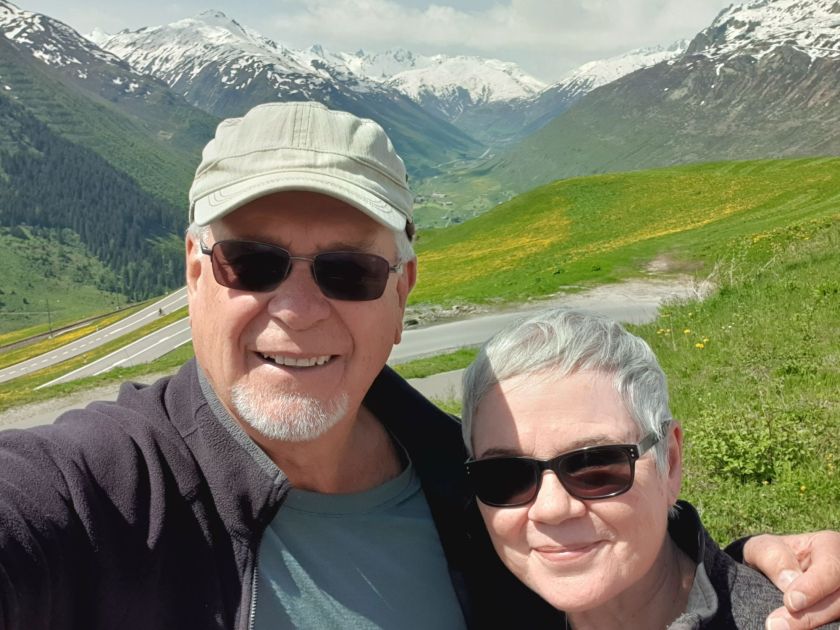
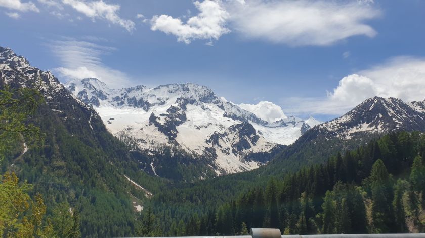
And that, 70klms away as the Galah flies, is Mont Blanc.

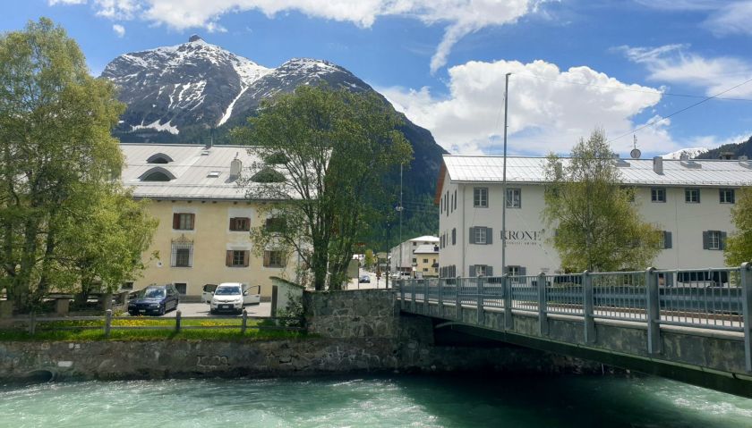
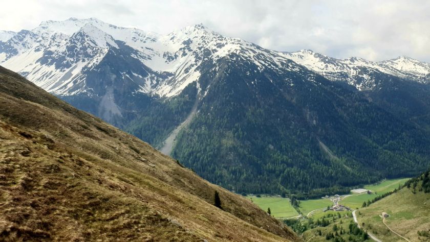
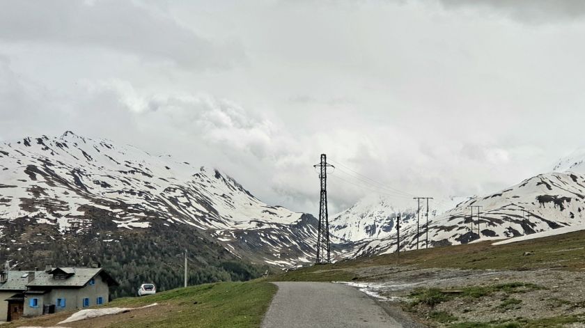
Saint-Michel-de Maurienne was pretty sleepy but we spent 2 nights there all the same, as a steady stream of bikers streamed past.

Thur 20th – Guillestre – 170k

8 Passes – Col du Télégraphe 1566m, Le Col 1522m, Collet du Plan Nicolas 2406m, Col du Galibier 2642m, Col du Lautaret 2058m, Col d’Izoard 2360m, Col de la Platriere 2220m, Col Agnel 2744m

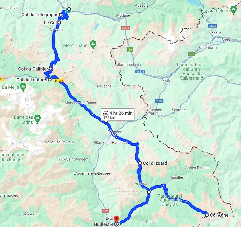
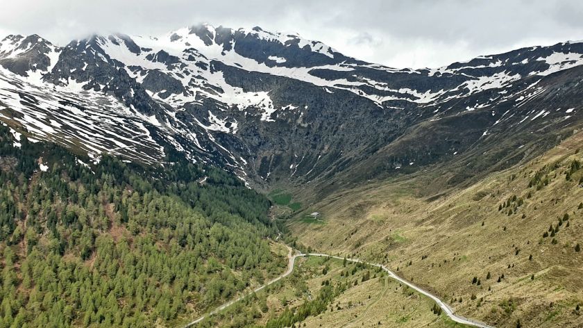
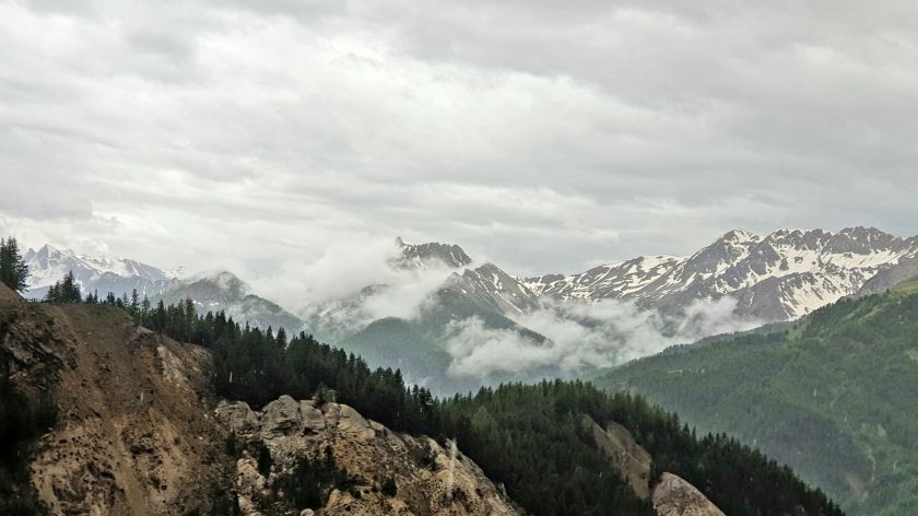
It was cool and bleak as we climbed 12klm out of Saint-Michel-de Maurienne toward the first of our 8 passes of the day.

Col du Télégraphe was first used in La Tour in 1911 it has been used over 30 times since, so is very popular with cyclists.

Col du Télégraphe

Then just down the road is Le Col followed by Collet du Plan Nicolas, neither of them deserving a marker

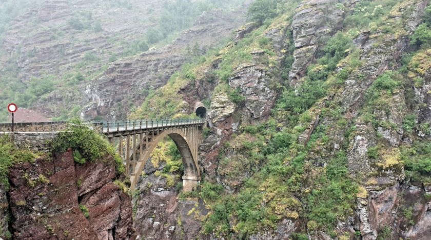
But Col du Galibier has all sorts of signs, including one that says ROAD CLOSED, in French of course.

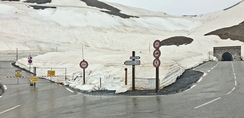
Built in 1890, the 363m long 4m wide tunnel kept the road open.

The other side of the tunnel.

Col du Galibier has been used over 57 times on La Tour de France and even once on the Giro d’Italia in 2013.

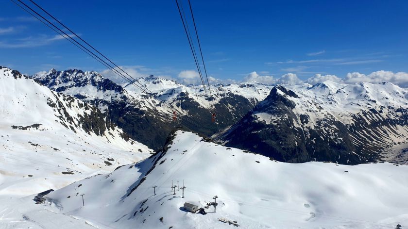
It is supposed to be used this year, but there is some doubt as it is still way deep in snow. May be they’ll use the tunnel.

Col du Lautaret is not far away.

It’s cold and bleak, but that hasn’t stopped those crazy cyclists. Much Respect.

A fair hike down the road brings us to unique and iconic Col d’Izoard

While just south is Col de la Platriere with it’s forbidding and barren scree slopes

and protruding pinnacles of weathered rock known as the Casse Déserte.
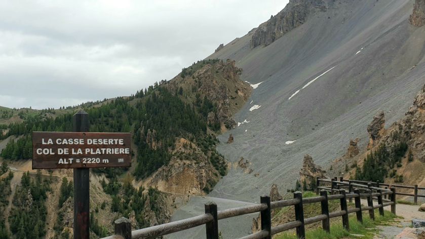
Quite impressive

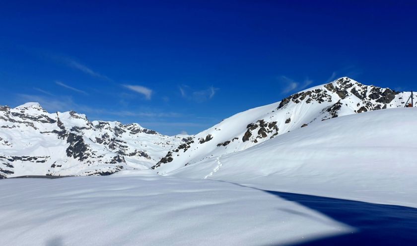
The roads through here are Moto Perfect, especially with the sun wanely peeking as we take another of those extended side trips to Col Agnel which at 2744m is the third highest paved road in the Alps and sits right on the Italian French border. The weather beat us to any visibility 😦

We had a brew anyway.

Down into the valley

And past Fort Queyras guarding it’s domain.

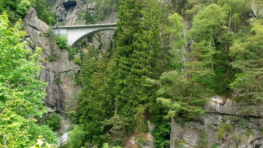
Before hanging a left with just a few kilometers to go we have the pleasure of the Gorges du Guil

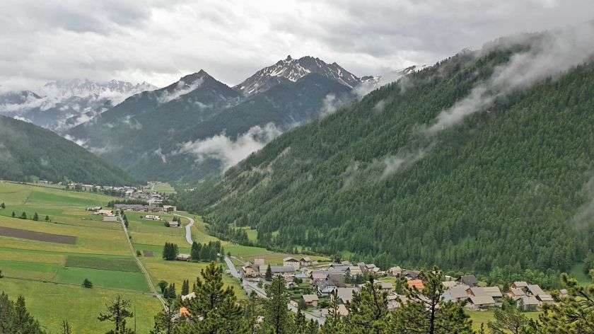
To sleepy Guillestre for the night.

Fri 21st – Castellane – 175k

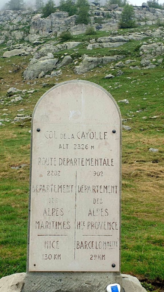
2Passes / 5 Bridges – Col de Vars 2108m, Col de la Cayolle 2326m

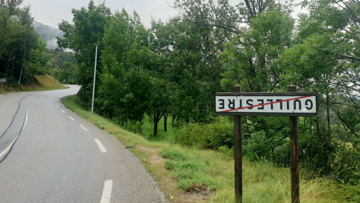
We climbed out of Guillestre and came upon this sign, we’d noticed a couple of them and thought maybe they’d just lost a bolt or such.

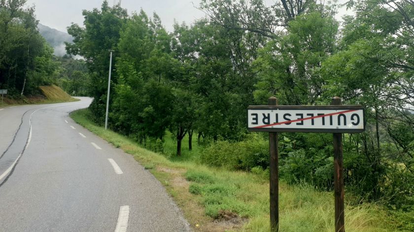
But they’re everywhere.

The act is a protest by local farmers to raise visibility of the challenges they face. Must be a lot of sneaky farmers out there.

Today is our final day on the Route des Grande Alpes.

It’s just a short run to Col de Vas with it’s plastered sign post

And descent to the valley below.

We’d been caught by a vast convoy of mainly Porches. And all going like stick which is understandable.

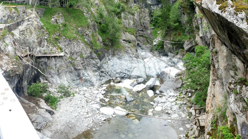
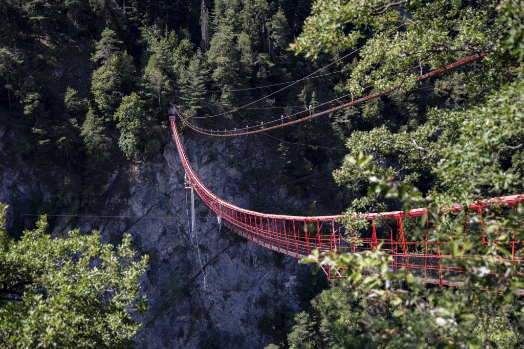
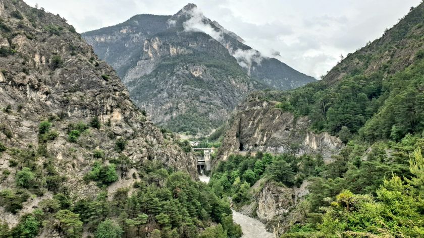
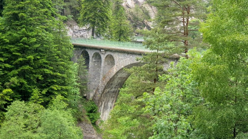
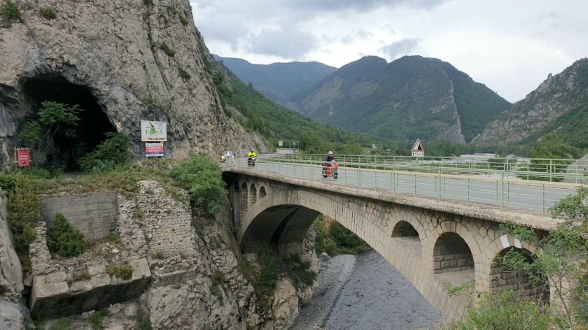
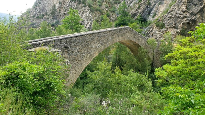
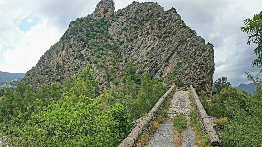
We took a short detour up a narrow road and through a couple of ancient villagers to the precarious Pont du Châtelet which crosses a very deep and narrow ravine.
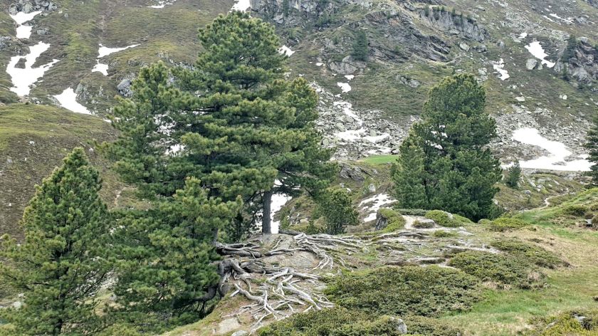
Wild country

Quite a feat building that.

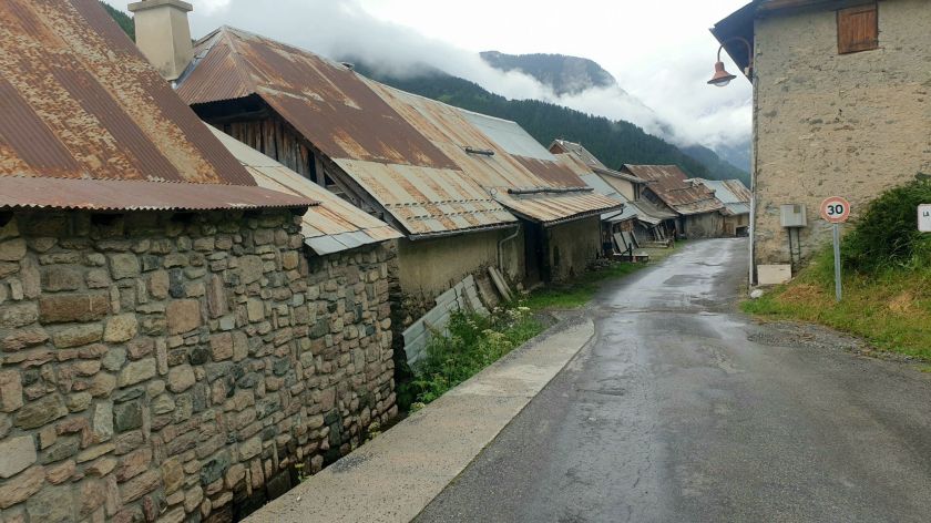
It’s a bit like going back to the early 1900s driving through some of these old villages.

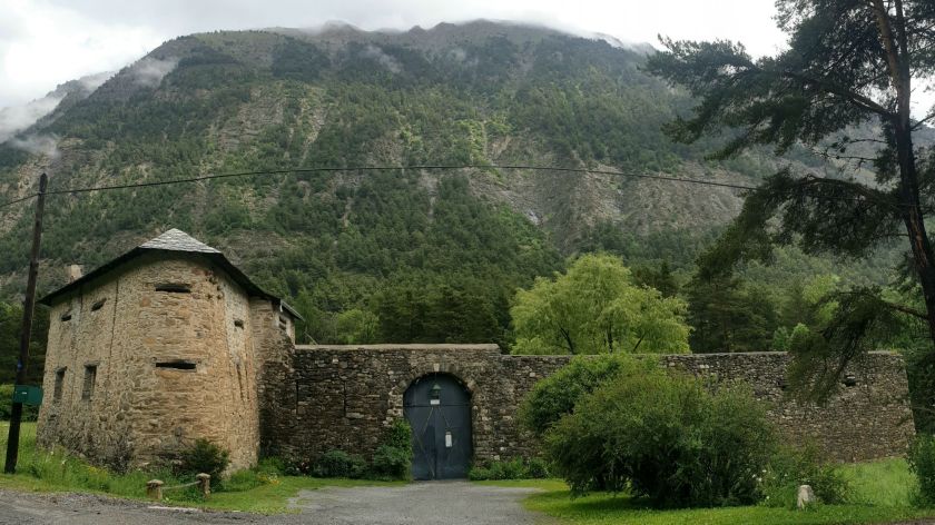
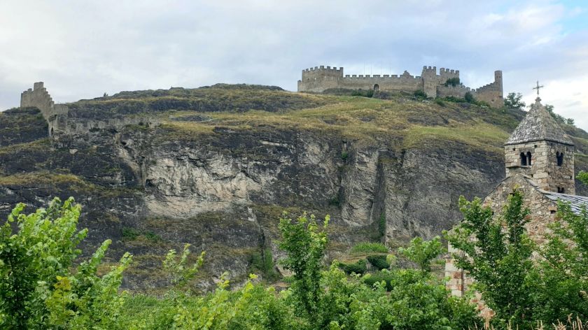
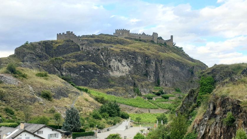
Redoute de Berwick built around 1694.

Followed by a lovely drive to Col de la Cayolle chased by more of those sports cars – I conceded defeat and let them past.

Actually, I always let anyone who is behind me past. I figure if they’ve caught up with me they must be going faster than me, so let them go by. I think I’m a rare breed though as very few others do the same around here, which can be frustrating. Another one of my pet dislikes.

This road was narrow and windy and wet. The cyclists were doing it tough.

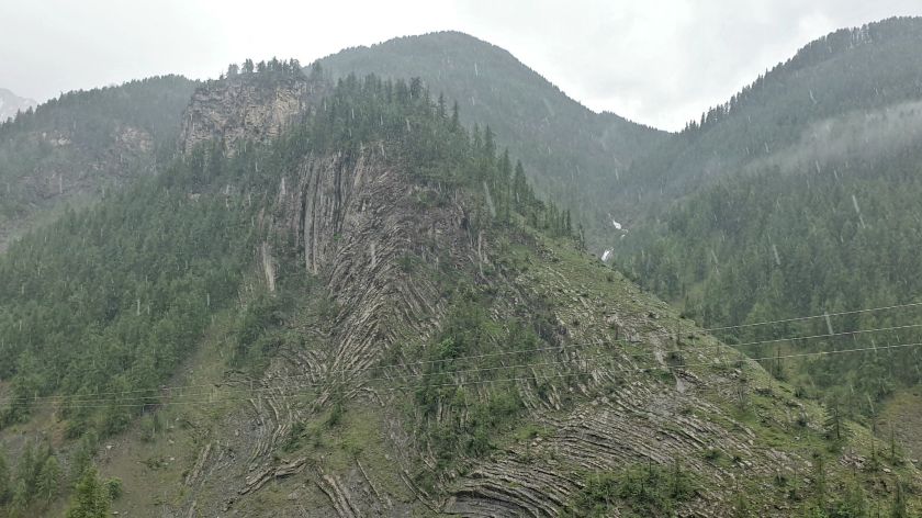
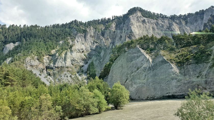
Some unusual strata.

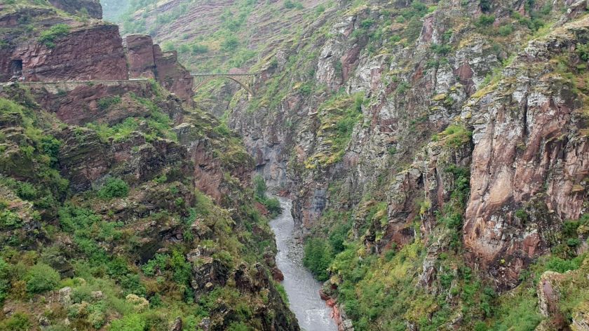
And then a collection of Bridges as we followed the meandering road through the Gorges de Daluis Regional Nature Reserve.

Pont sur le Var

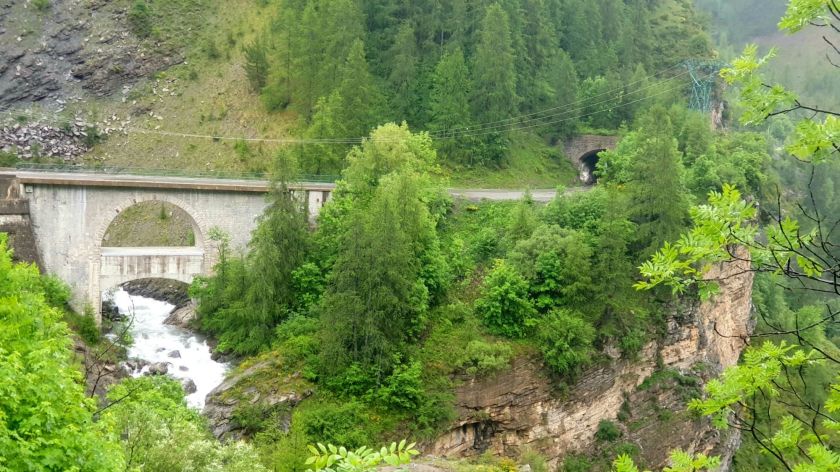
Vars river running through the Daluis Gorges.

We also passed the Vespa Boys, gave them a Panda toot.

Another Pont sur le Var

Pont de la reine Jeanne constructed in 1728

It still has a safe working load of 1.5tonnes – seriously.

Today’s been a big pic day so we’ll finish it off with Barrage de Castillon which holds back Lac de Castillon

Plenty of these show offs around. Lucky ducks.

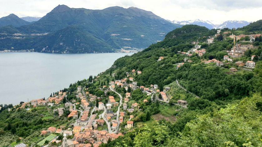
We propped in Castellane for 2 nights mainly watching and hearing the literally 100s, and I mean 100s, of Motos travelling through as it sits at the bottom of the Route de Grande Alpes. And the weather was perfect.

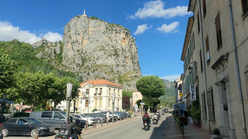
Drinking coffee, watching noisy bikers go past, and wondering who had the bright idea of building a church way up there. Bet it wasn’t the same sucker that lugged all the gear.

Sun 23rd – Sault – 180k

Today we begin our long swing West and North. It feels a bit like the beginning of the end. It’s certainly a long way from the start of this adventure – 3 months.

We start our pic fest of the 25klm Verdon Gorge at the historic Pont de Carajuan, an ancient pedestrian bridge which spans the Verdon River.

Carajuan Stone Bridge

The road is very narrow and hazardous in places.
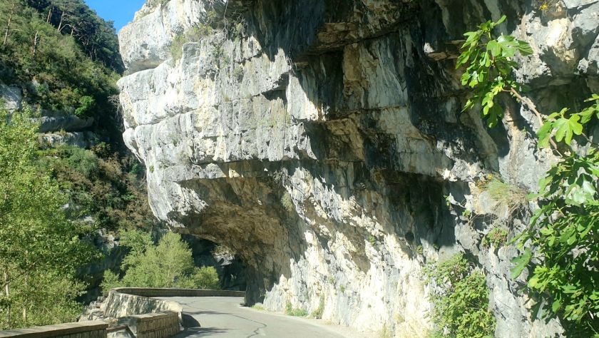
Duck!

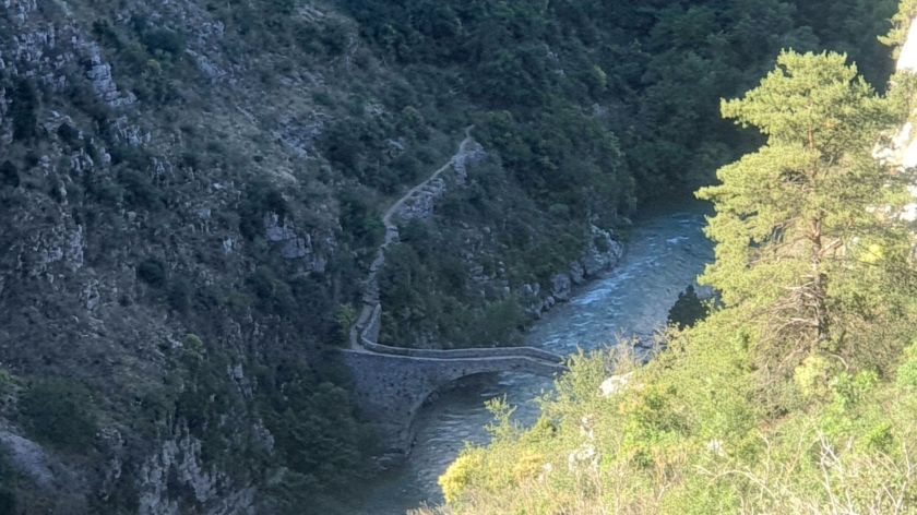
The 11th century Pont de Tusset is a long way down there.

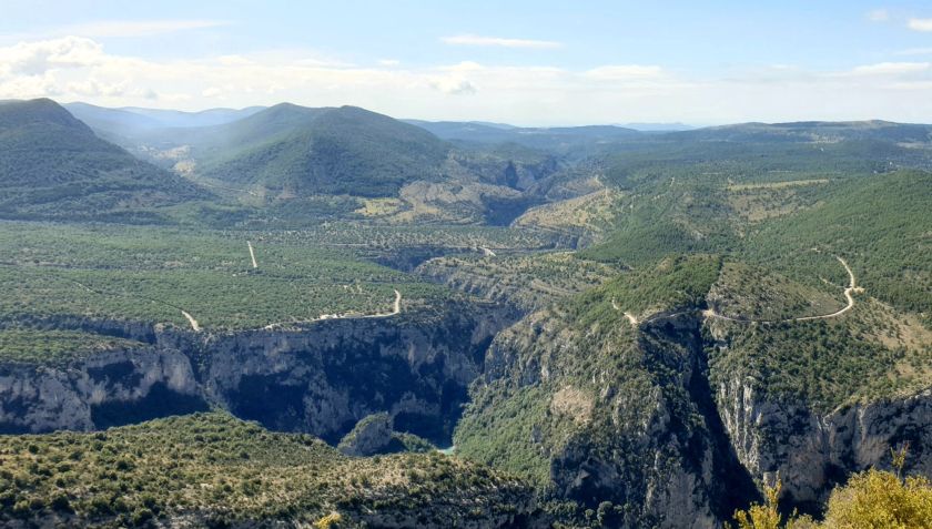
Gorges du Verdon is about 25 km long and up to 700 metres deep.
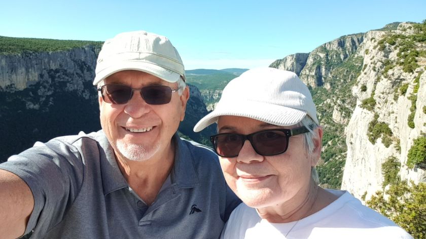
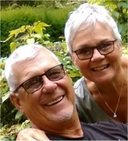
Me and my Gal.

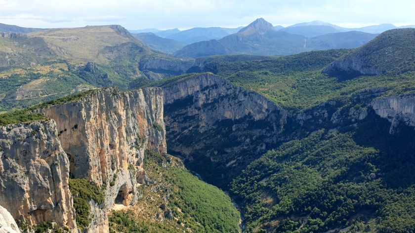
Gorge-eous eh. The pics don’t even get close to it.
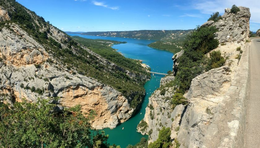
Galetas Bridge

The Verdon Gorge end at Pont du Galetas at Lac de Sainte Croix.

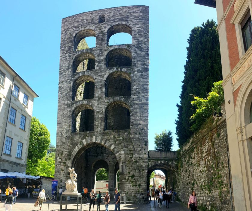
Up the road is the village of Riez with it’s remains of a 1st century
Roman temple.

Colonnes Romaines

There was lots of activity in Riez today. I have no idea why, maybe something to do with the summer solstice.

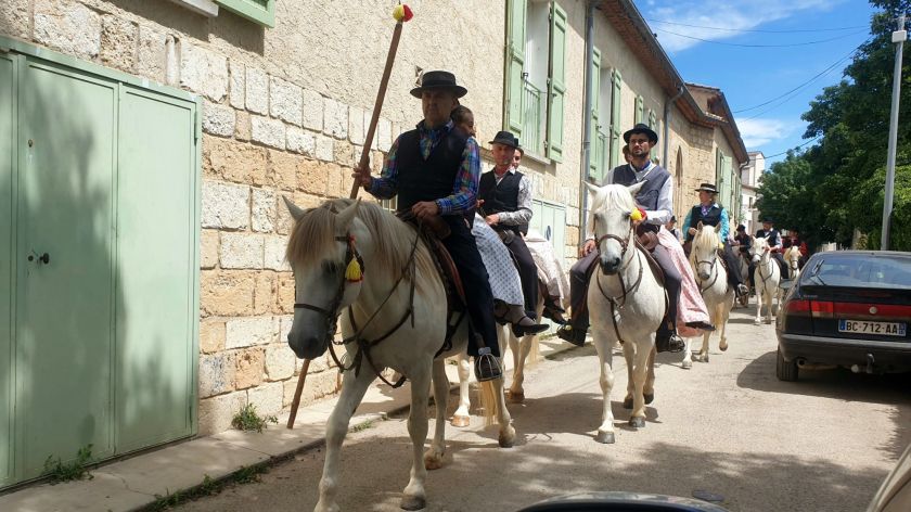
These guys were getting into the medieval pomp and pageantry.

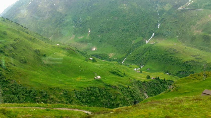
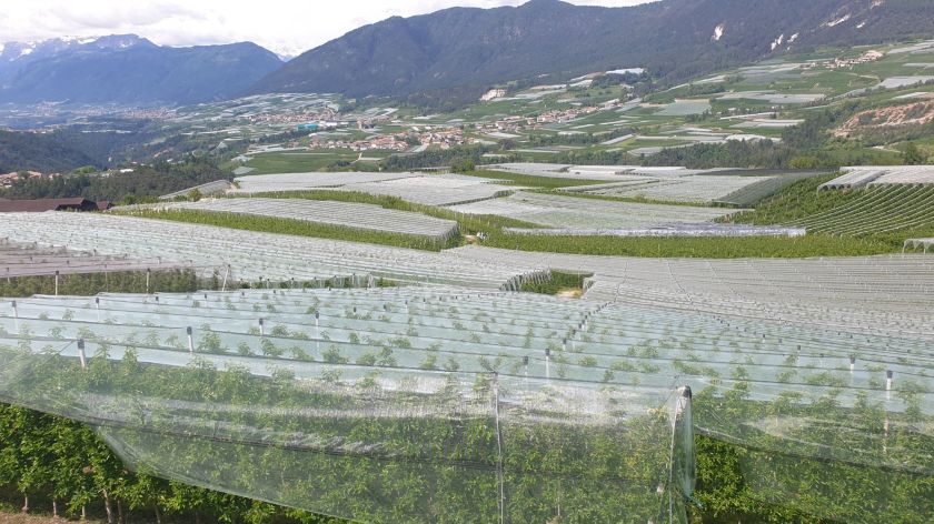
The countryside is magnificent in the early summer.
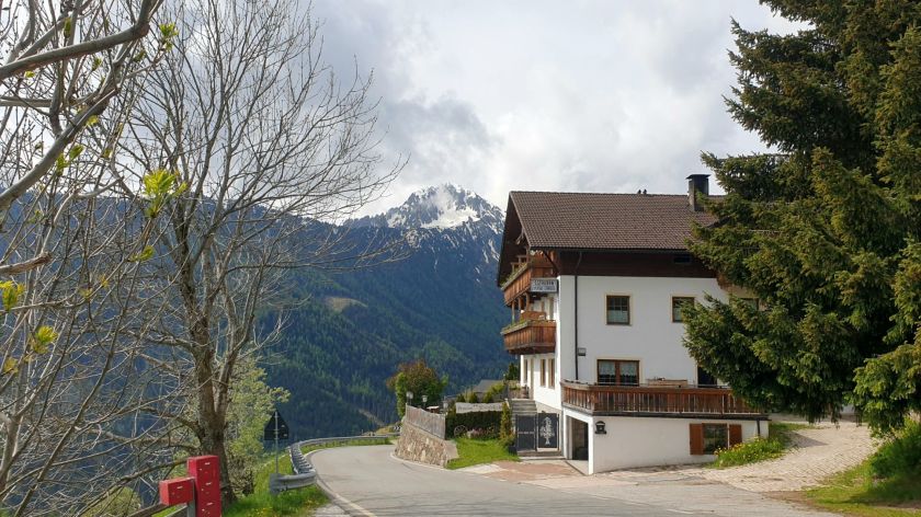
Viens

We’re in the middle of Lavender Country.

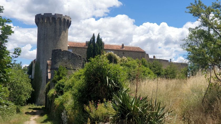
In the village of Simiane-la-Rotonde we have the 12th century Château de Simiane-la-Rotonde

Simiane-la-Rotonde Castle is a whole lot more impressive inside but it was closed, or it was siesta time. The French of these parts are very siestary.

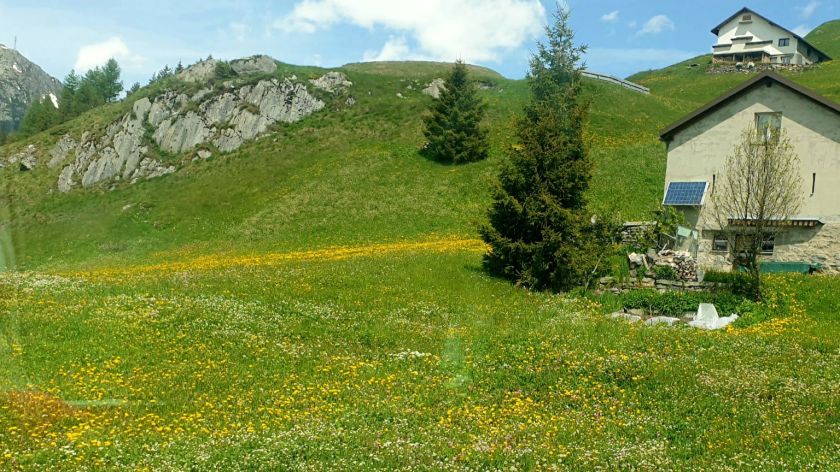
And this satellite farm just short of Sault.

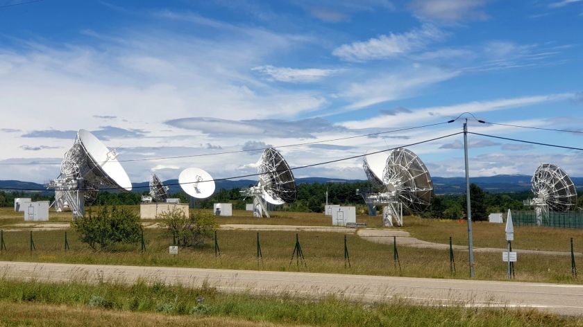
I was half expecting the MPs to rock up as I took this pic. Then I remembered it was still siesta time.

Sault is quiet little village overlooking a vista of farm land. It’s popular with motor homers, they were parked everywhere.

View from Sault.

Well, that’s it for this week folks. It’s a huge read but I hope you enjoy it.

I’m not sure of the next installment of the blog, my computer had a close encounter with a cup of coffee, and although everything is working just fine on it, it’s network capabilities has ceased to function. Believe me, without internet there’s not a lot that can be done nowadays. So I’ve done the last 3 days of this week on my tablet, which isn’t too bad, but it’s a pain doing the blog.

Anyway we’ll see how we go. Next week in Paris.

Wk 12 – Matterhorns & Blanc Monts

Monday 10th to Sunday 16th June

Mon 10th June – Andermatt SE Loop – 155k

3 Passes – Oberalp Pass 2044m, Lukmanier Pass 1974m, St. Gotthard-Pass 2106m.

It’s a miserable looking day with cloud base down to street level in Andermatt which is 1500 asl anyway. We head off for Oberalp Pass.

Oberalp Pass, cold, white and miserable.

But immediately after crossing the pass the clouds cleared.

Railway Viaduct Val Bugnei

Looking back at Disentis Abbey. We’d stopped here for a night in 2022.

Check the retaining work going on here.

This is an abseiling park in the gorge below the bridge above

These 4 pics are taken within 100mtrs of each other.

Further down the road (is it ‘up’ if you’re travelling north, and ‘down’ if you’re travelling south??) Further south was Lukmanier Pass with its Lake Sontga Maria.

Lake Sontga Maria

Lukmanier Pass – The 57klm long Gotthard Base Railway Tunnel runs about 1500m underneath here.

We kept going down to Biasca where we turned right for the famous Gotthard Pass with its various roads and tunnels.

Looking down on Airolo from Punto Panoramico San Gottardo

The original cobble stone pass, Tremola road, was closed. Have a close look at this pic and you’ll see how much work is involved in keeping these passes open. We rode this in 2022.

Gotthard Pass

Another Grand Tour of Switzerland Foto Spot- Hospental, just short of Andermatt.

Tues 11th – Andermatt NE Loop – 55k

Today was supposed to be a 120klm loop ride taking in the amazing passes of Furka Pass 2429m, Grimsel Pass 2164m and Susten Pass 2260. But they were all closed 😦 Which was a bummer x2.

So in the wet and cloudy conditions we thought we’d see how close we could get to Susten Pass. We got to within 4klms of the top where a barrier brought matters to a sudden halt at Sustenbrüggli Cafe which was open.
There were about 30 guys heading off in full mountaineering kit – there are some serious peaks up behind here.

Sustenbrüggli Cafe – can anyone identify the wayward moto??

We then came back to Wiggen where there’s the 1940s Wiggen Factory cable car – no amount of Google searching shows any history.

Licensed to carry 10 people – the cable car, not the Panda car.

We had a brew and our lunch, while Brown’s Cows marched by with bells ringing.

A couple of bridges over the deep gorge at Göschenen.

Then the historical Häderlis Bridge.

Häderlis Bridge. Built in 1649 on the site of an older footbridge. A flood destroyed it in 1987. In 1991 an identical stone arch bridge replaced it.

We retired to our comfy apartment for hot chocolate and strudel – as you do in Switzerland.

Which brings me to a point of immense wonder. YOU DON’T SEE ANY FAT PEOPLE IN SWITZERLAND! Now considering their shops are stuffed with all sorts of delicious breads, and just as many cakey things, not to mention that apple strudel, with ice-cream. Why is that? Well, you can say you got it from me – “there are no flat places in Switzerland”, so you’re either walking or pedaling UPHill, steeply, or you’re doing the same thing DOWNHill, just as steeply.
So there you go, you can eat as much strudel and other carbs as you like, you just have to live in Switzerland, and not own a car or moto 🙂

Wed 12th – Andermatt Lay-Day

A lay-day is where we do nothing. Well that’s the general idea, but I’m usually catching up with this blog, or planning the next few days travel, or doing my bookkeeping job.

But today the 171klm Stage 4 of the Tour de Suisse is coming through town, bypassing it actually. So we walked a couple of Ks (remember yesterday’s strudel) up the road and watched them go through the final sprint section for the day.
Norma and I enjoy watching the highlights of the Big 3 European bike races on SBS in Australia, and by comparison the Tour de Swiss is pretty low key. But that doesn’t mean the riders and teams and organisers don’t take it really really seriously.

There were a couple of dozen of these Team Buses – all the big teams.

And there were dozens and dozens of these team cars.

And there were dozens and dozens and dozens of these motos roaring up the road.

And there 24 teams and so 20 dozen of these masochists – I takes me ‘at off to ’em.
They can eat as much strudel as they like – but I bet they don’t.

This is the breakaway, they were a long way ahead of the rest with only 12klms to go. The guy in the red helmet is Adam Yates who eventually won the race.

This is the main peloton, but there were 3 or 4 others. These guys must have been freezing; it was about 6c.
We clapped and cheered them on – we were the only spectators at this sprint section, so I’m thinking the crazies who you see on TV don’t follow the Tour de Swiss – there were no TV cameras either, so that probably explains it.

We had fun and wandered home to our delightful apartment, which today had been surrounded by market stalls.

Thurs 13th – Brig & The Matterhorn – 145k

No Passes Today

Because Furkapass is closed, we’ll load our little white Fiat 500 Hybrid onto a train and take the 15klm Autoverlad Furka tunnel which only takes 20 minutes.

We were 2nd on board

GOMS Suspension Bridge – Norma being very brave.

Our next stop was GOMS Suspension Bridge which was built in 2015 and is 280m long, 1.4m wide and crosses the Lamma Gorge 92m above the wild Rhone River.

But the highlight of the day was catching the Gornergrat Railway to Gornergrat 3089mtrs, where, along with hordes of other tourists, you get spectacular views of the Matterhorn at 4478m. Bear with me, because it really is a sight.

This from the train just out of Zermatt – If you want to save around A$160 each you can see it from Zermatt here and here. They’re both a short walk from Zermatt station.

Anyway, we didn’t know that so took the ridiculously priced Gornergrat Railway, which climbs 1450m from Zermatt to Gornergrat Railway Station. This line was opened in 1898 and was electric rack from the start. Quite impressive.

Me and me mug ‘aving a brew.

Matterhorn sans me mug.

These guys having a lot of fun and making a lot of money. Good for them.

Me and me gorgeous lady.

A wider view

And another Swiss Grand Tour Foto Spot.
It took me 10 minutes to get to take this pic. Which brings me to another gripe (sorry); if you’re one of those who can’t help but take untold pics of self in various poses while holding up everyone else, please stop it 😦
I took my pic, and the guy behind me asked me if I wanted him to take one of me, I told him I wasn’t that vain, I’m sure it ruined his day 🙂

And so to Brig.

Fri 14th – Sion – 115k

1 Pass – Simplon Pass 2006m,

Another cloudy day as we kept heading west. First was a detour to Simplon Pass. Napoleon first had this road constructed in 1802.

Simplon Pass in the fog, with the Simplon Eagle (centre)

The 678m Ganter Bridge, which became known worldwide because of its spectacular span and its movable pillar feet, by means of which the bridge could be shifted by up to 50cm to compensate for slope movements.

It was a very pretty drive on another slight detour to observe the Pont Suspendu de Niouc which is one of the highest suspension bridges in Europe.

Built in 1922, the 190m span is used as a platform for bungee jumping. I was so disappointed it was closed on the day.

Lac Souterrain De Saint-Léonard was next on the plan. Saint-Léonard underground lake is the largest underground lake in Europe, apparently. We paid our Euros and took a boat ride.

Crystal clear.

And plenty of these large introduced rainbow trout.

To lovely Sion, where we took our customary wander.

Handsome brute hey. Me, not the goat. You’ll note we don’t do many pics of self, mainly because it’s about what we’re seeing and not about being seen.

A plumber’s nightmare

The 11th century fortified Basilique de Valère. It’s a steep climb up here

The ruins of the 13th century Château de Tourbillon

Looking out over Sion which, even though it’s in Switzerland, is very very French.

Sat 15th – Chamonix – 130k

3 Passes – Col des Planches 1411m, Col de la Forclaz 1527m, Col des Montets 1461m

It was another damp morning as we climbed out of Sion on our detour loop to Verbier which is a ski village in SW Switzerland. It sits at 1500m and is open for skiing 10 months of the year.

But first we did our first pass for the day. Col des Planches at 1411m is nothing special but it’s set in some lovely forest with plenty of logging happening. We saw hundreds of these log stacks throughout the Alp with a lot of saw mills servicing the obviously huge timber industry.

Col des Planches

Looking down on Val de Bagnes as we climb to Verbier.

Verbier was very quiet it being the season ‘tween winter skiing and summer hiking. We spent our last Swiss Francs on a coffee and descended towards this region’s capital, Martigny, via Val de Bagnes.

Overlooking Martigny and the medieval La Bâtiaz Castle where we stopped for a brew and some lunch.

It was a lovely drive, which would have been an even better ride, to Col de la Forclaz .

Some people have all the fun.

You can tell as soon as you cross the border from Switzerland, where the roads are better than perfect, into France, where the roads are terrible, not unlike our Victorian roads in Australia.

Col des Montets isn’t that high but it’s extremely popular with hikers and sightseers.

Col des Montets

With views of the remarkable Aiguilles Dorées

And so to the heart of French mountain sightseeing – Chamonix-Mont Blanc – It is one of the oldest ski resorts in France, and hugely popular with alpinists and mountain enthusiasts. It also hosted the first Winter Olympics in 1924.

The view from our apartment window with the La Jonction glacier in the mid foreground. It really does look like it’s ‘right there’, but it’s probably 7 or 8ks away.

Sun 16th – Mont Blanc Views

Today we joined the queue for the massively popular two stage, and the world’s highest vertical ascent, cable car ride to the top of Aiguille du Midi which sits at 3,842m and where we were hoping to observe western Europe’s highest mountain at 4,806m, Mont Blanc. Regrettably for the hundreds of tourists it was pretty much a white out.

The views on the ascent where pretty good though.

La Jonction glacier close up.

Plenty of climbers.

But this was as good as we got of the famous mountain.

But we got this one the next day from a different viewpoint, which should be, will be , in next week’s blog. See you there and then.

Wk 11 – Switzerland

Monday 3rd to Sunday 9th June

Mon 3rd June – Samedan – 120k

1 Pass – Maloja Pass 1815m

We’re in no hurry this morning as we have our included breakfast before taking our leave from Mandello del Lario and meander up Lake Como’s eastern shoreline to Varenna where we catch the vehicular ferry to Menaggio on the western shore. Here, all relaxation comes to an abrupt halt as we join the helter-skelter of traffic travelling this singular road, there being no by-passing freeway on this side of the lake.

Before us are raised the Swiss Alps as we head north for Chiavenna with its Romanic Ponte sul Mera beside which we had morning tea, with strudel, followed by a walk-around.

Kissing Rocks or Sasc Taca

Sasc Taca

are just short of Palazzo Castelmur, an early 18th century castle which is now a museum and accessed via its low 6 arched 1897 bridge.

Castelmur Castle

There is only 1 pass trying to bar our way today. Passo del Maloja is a short sharp climb to 1815mtrs.

Maloja Pass

And so to Samedan which is just up the road from St Moritz with all its glitz.

Tues 4th – Samedan Loop – 75k

1.9 Passes – Passo del Bernina 2328m, Albulapass 2312m

Bernina Pass is just down the road and it’s a very popular run for motorcycles, pushbikes and sporty automobiles.

But first we stop at Val Bernina and take the cable car up to Diavolezza, 2958m, where we can see all the highest peaks of the Eastern Alps, including the Piz Bernina, and the Pers Glacier. There are some spectacular views from up here.

We stop at Bernina Pass and have a brew before doing a U-turn back down the mountain.

Looking east from Bernina Pass – Stelvio Pass is out there somewhere.

I know that Albulapass is closed, but we see how close we can get before being turned around.

We get to within 3klms from the top, which is still a fair ways to go.

We head back down and have lunch at La Punt-Chamues.

And finish the day with a visit to St Moritz where a coffee is A$10, so we went without. Actually, we’ve found everything is incredibly expensive in Switzerland, at least compared to what we’re used to.

Leihbibliothek St. Moritz

And a couple of pics from Samedan where we’re staying.

Thur 6th – Chur – 185k

2 Passes – Julierpass 2284m, Passo del San Bernardino 2066m

It is a glorious day as we take our leave of Samedan and retrace our steps through St Moritz and Silvaplana towards Julierpass.

Looking back over Silvaplana.

Julierpass

Lai da Marmorera

Lake Marmorera earthen wall.

Looking up this long valley towards Albula/Alvra

We took a left at Albula/Alvra and a long return loop to San Bernardino Pass. I hadn’t realized that we’d actually traversed this pass in 2022.

The 6.6klm San Bernardino Tunnel goes directly underneath this.

We found our 3rd floor apartment in Chur (pronounced ‘Kir’ for we Aussies) and then found that all parking in Kir is A$50 a night 😦 Motorbikes are free of course.

Fr 7th – Glacier Express – Chur 2 Andermatt

The Glacier Express is a tourist-oriented train service running between St Moritz and Zermatt and access to the Matterhorn.

I pinched this pic off Wikipedia.

We did a round trip from Chur to Andermatt.

The headwaters of the Rhine River

And looking down on the the Rhine Gorge – in 2022 we travelled the road to the south of the Gorge affording these incredible views.

Oberalp Pass

Trying to ignore all the bikers laughing behind us.

Spring meadow flowers

Looking down on Andermatt

This should be us!!

And it really is this green.

Lai da Curnera

The Glacier Express is very popular, and very expensive.

Sat 8th – Chur SE Loop – 150k

2 Passes – Fluelapass 2384m, Wolfgangpass 1632m,

Another Loop drive, that should be a ride.

Leaving Chur with Haldensteiner Calanda and Felsberger Calanda in the background. Both of them over 2700m.

And behind me. Boys doing what boys do best!??

Onto Fluelapass which was very white.

Looking south from Fluelapass

Then heading back north from Fluelapass

We stopped here and a had a brew and some lunch.

Another Grand Tour Foto-Spot.

These trees literally hanging onto the side of the cliff.

We continued on over Wolfgang Pass which isn’t anything to write home about.

And more classical Swiss scenery like this.
I can appreciate that many will get bored with so many of these pics showing very much the same things. But the point is that we come from Australia where absolutely nothing looks anything like this. Where pretty much everything is a varying shade of brown, even the green, and everything is flat, the tallest mountain being Mount Kosciuszko at 2228m, and the roads are totally rubbish – especially in Victoria. So you see it’s all a novelty for we few, we fortunate few, from the Land Down Under.
Enough of that.

Sun 9th – Andermatt – 180k

2 Passes – St. Luzisteig Pass 715m, Klausenpass 1948m

It’s a cloudy and damp day as we pays our 3 nights A$150 parking (yes, seriously) and take our leave of Chur.
Our first stop was St. Luzisteig Pass, which of itself was nothing significant apart from the fact that the Swiss maintain a military presence there with guard posted.

These sheep being the biggest threat to their security I’d think. Norma thought they were cute anyway.

We came this way so we could sneak through the SW corner of Liechtenstein, just so we could say we’d been there.

Gutenberg Castle

It took us all of 10 minutes to drive through Liechtenstein including the time it took to take these pics.

We stopped alongside Walensee

Walensee – that’s a man made tunnel over there, goodness knows what for because there’s no road or rail leading to or from it that I could ascertain.

More Swiss countryside.

To Klausenpass where it was very cold and swarming with moto riders – lucky ducks. We stopped for a brew and lunch of fresh rolls with banana.

We chased the Klausenstrasse Rte17 with more of that eye opening scenery

To Rte2 and then it was south on the freeway to Andermatt where we’ll spend 4 nights.

And that’s all for this week folks. Hope you enjoy it.
See you next week from Chamonix and Mont Blanc in France.

Wk 10 – Bolzano to Mandello

Monday 27th May to Sunday 2nd June

Mon 27th – Bolzano Nth Loop – 155k

3 Passes – Penser Joch 2211m, Sterzinger Jaufenjoch 1998m, Passo di Monte Giovo 2094m.

It’s a beautiful day as we brave our way through the morning school drop-off, except in Europe they don’t clutter the road with their badly driven SUVs, but they escort their kids to school on their ‘all over the road’ pushbikes.

We eventually got out of town and had a roadside peak at the mid 13th century Castel Roncolo and it’s smaller sibling Castello Reid.

Castello Reid

Castel Roncolo

We then followed the SS508 north. It gets really pretty along here as we climbed towards Penser Joch or Passo Pennes.

At the top of the Pass we ran into a bunch of guys on their tiny noisy 50cc two stroke motorbikes. They straggled in in 1 and 2s from the northern side of the pass and their reactions showed it had been quite a feat for their little smokers, which is understandable as the pass is 2211m
There were about 15 of them. Just a couple of pics.

We headed down.

This region is known as either Northern Italy or South Tyrol, but what ever you call it, it’s definitely Austrian in architecture. EVERY house looks like this or a slight variation on the same theme. It was originally Austrian but was annexed by Italy following WW1.

We drove around Vipiteno Sterzing looking for a car park. It must have been market day because there were more cars than parks. Plenty of motorbike parks mind you! We kept going and turned south west towards home.

First stop was Jaufen Pass, the lower part of Passo di Monte Giovo.

Where we stopped amidst a number of those smug motorbike riders. We had coffee and delicious apple strudel – as you do.

This picture is where we indulged in coffee and cake. But the significance of it is the big doll/manikin of a Marmot or large ground squirrel (left), which live up in these high passes – we did see a couple scampering around as we descended from Penser Joch.
This lone establishment not only sold scrumptious delights but also Marmot Ointment, a proclaimed miracle working Marmot extraction, better known as snake oil. We left it on the shelf and headed south and down, down down.

These two guys on their ancient tractors, holding up traffic and sponsored by a prominent finance company. I know this because the pic I took of the rear tractor’s trailer had a QR Code that triggered said sponsor’s web page on my phone. Technology hey!

A line of dawdling Harleys. They sound good though.

We stopped beside this thaw laden stream for a brew and lunch.

Before dropping into Merano where we found a place to park our limousine.

The heavens opened as we headed back to Balzano, but we’d had a good day, and we were dry.

Tues 28th May – Bolzano

These corner bay windows are a very common feature on city buildings in this area.

Mussolini’s Bolzano Victory Monument

13th century Maretsch Castle

Bolzano Cathedral

City Hall and Monument dedicated to King Laurin Denkmal

Wed 29th – Bolzano to Bormio – 205k

4 Passes – Passo della Mendola 1363m, Forcella di Brez 1398m, Passo del Tonale 1883m, Passo dell’Aprica 1176m

After buying a new pair of shoes, it was a bit of jungle escaping from Bolzano only to find the push bike riders had gotten out of bed way earlier than us as we climbed to Mendel Pass – there were dozens of them.

Ascending Mendel Pass

Going down the other side.
We’ve seen vast amounts of these crops in this greater region. I suspect they’re apples or stone fruit trees

Forcella di Brez was next on list of Passes for the day. It was a disappointment, so we joined the main road and headed west. We stopped for a brew and some lunch outside of Dimaro

Before climbing to Passo del Tonale which had some spectacular views.

Military Memorial Passo del Tonale where the remains of 847 Italian fallen soldiers are collected in the shrine, fifty of which are unknown.

Across the road from the Memorial

Going down

The intention had been to cross the Passo di Gavia which is one of the ‘must do’ passes in the region. It was closed. I’d tried to time our visit to this area so as to be able to cross these famous passes, but it seems my timing is out for this year, because they’re usually open by now.
Passo di Foppa was also closed so we had to take the long way around, adding 60k to the day, via Passo dell’Aprica which is nothing significant.

We found our pleasant apartment in Bormio.

Thur 30th – Bormio NE Loop – 85k

3 Passes – Passo Torri di Fraele 1930m, Foscagno Pass 2291m, Passo Eira 2208m.

We were to do Stelvio Pass, at 2757m, today. But it’s closed, and will be for quite a while by all accounts. Which is very disappointing for all the bikers and push bikers in town, and one Panda driver, who’d all hoped to enjoy the famous hairpins. The live cameras tell the story.

So we headed West for the day. First port of call was Torri di Fraele, or Fraele Towers which are 14th century signal towers.
And it’s an impressive climb, or would have been if we’d been able to see where we were going for the cloud cover. But this is what it should look like from the top looking down.

Torri di Fraele – from Wikipedia

Google Maps

16 hairpins

And believe me, they are sharp. My pics

And the sun came out, just for this at the top of Torri di Fraele

We descended as we’d ascended

and continued to Foscagno Pass and Passo Eira where we had some lunch.

Foscagno Pass

Passo Eira

It was very quiet in terms of traffic, which was odd because it was the only way into the region from the north. We retraced our steps to Bormio.

Fri 31st – Bormio to Mandello del Lario – 170k

1 Pass – Passo Agueglio 1167m

It was bucketing down as we exited Bormio heading for Lake Como. There were a number of bikers leaving town as well and I felt their pain because not only hadn’t they been able to enjoy the amazing passes in the area but they were getting seriously cold and wet for the pleasure.

It rained all the way to Lake Como, then stopped.

We dropped into the tiny village of Coreano Plinio

Arche degli Andriani

We took a slight detour by way of Passo Agueglio which is really just a (narrow) loop off the main road, but an enjoyable drive. With some nice views down to Lake Como.

It was 3pm when we pulled up at Mamma Ciccia’s apartments and rooms, and found that the Moto Guzzi Museum was open so we went and had a look – again. I’m a bit of a Moto Guzzi fan and have owned 4 of them over the years, having taken 2 of them to Europe, in 2016 and 2019. Maybe I should have brought one this time 😦

We’d visited the museum in 2016, when we were riding a Moto Guzzi Stelvio.

We were so much older then –

We’re younger than that now 😉

The original 1919 Moto Guzzi

Moto Guzzi factory circa 1958 – output 36,500 units a year.

The latest Moto Guzzi Stelvio.

And as I sit here typing this, this little beauty is right in front of me.

And any visit to Mandello wouldn’t be complete without saying “Gidday mate” to Carlo Guzzi, one of the three founders of the Moto Guzzi marque.

Sat 1st June – Lake Como

Today’s looking pretty good so we catch the ferry to Como via Bellagio.

Mandello del Lario

Looking north on Lake Como. We’ll be up in them thar hills next week.

Bellagio

Bellagio

Bellagio was wall to wall tourists, doing what tourists do best

And then it was the next ferry to Como, which was pretty much continuous views of the homes of the rich and famous, or even not so famous I guess. But we’d all like to own one of these.

Como was wall to ceiling with tourists. We wandered for an hour.

Cattedrale di Santa Maria Assunta. 1369 to 1770. That’s a long time.

Torre di San Vitale

Porta Torre Como

Chiesa di Santa Cecilia

There’s a lot to see in Como, but we didn’t have the time. As it was we’d (I’d) misinterpreted the ferry time table so we missed our connecting ferry from Bellagio back to Mandello. So we continued onto Varenna and caught a train back to Mandello.

From Monday we’re in Switzerland. See you week.